 Moniteau County Missouri

John D. Williams Family Cemetery listings
Moniteau County Missouri
John D. Williams Family Cemetery listings
The Listings of Linn Township Cemeteries published by the Moniteau County Historical Society states:
Located just upriver from Sandy Hook in Township 46, Range 14, Section 12.
Directions to cemetery: Located high on the bluff overlooking the Missouri River at the north edge of Sandy Hook on the Muri farm. From Jamestown, take Hwy 179 east and then south toward Sandy Hook. Just before coming to the Sandy Hook city limit sign, turn left onto a private drive. The cemetery will be at the top of the hill to the right. It appears to be an old "Indian" mound with these known burials.

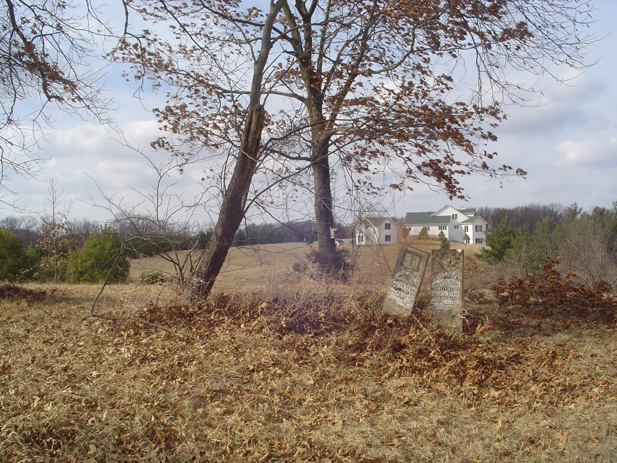
James Albin and Alan Sparks visited this cemetery February 7, 2009 when the pictures were taken. The immediate cemetery itself did not appear to be maintained but the area around it appeared to be mowed regularly.
All photos and photos linked to from this page are Copyright © 1997- Alan Sparks - www.moniteau.net, All Rights Reserved.
Please do not use them on other websites (including Find-a-grave) without permission.
Approximate GPS Location: 38.754589,-92.40996
This cemetery is on private property and always ask permission to visit cemeteries on private property. The land owner lives in the house seen in the background of the center picture above.
* = Calculated Date based on age; d/o = daughter of; s/o = son of; w/o = wife of; m = married
![]() = Click for picture
= Click for picture
Last Name, First Name, Middle, Birth Date, Death Date, Comments
? E W -- appears to be a footstone
![]()
Williams John D -- 1797 Aug 30 - 1844 Oct 22 -- "A
member of the Baptist Church" -- Pic 1:
![]() Pic 2:
Pic 2: ![]()
Williams Julotta -- 1803 Aug * - 1873 Mar 03 -- Aged 69y 6m 13d -- w/o John D
Williams -- Pic 1: ![]() Pic 2:
Pic 2: ![]() Pic 3:
Pic 3: ![]()
Please go to the
contact page with questions or comments
about this web site
Copyright © 1997-
Alan Sparks - Moniteau County MOGenWeb, All Rights Reserved.
Last modified:
October 29, 2014